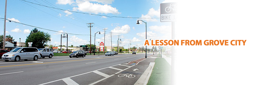

Powerful Ideas for Northwest Indiana
Hoch Associates has been a long time advocate of the Indiana Regional Cities initiative which was originally announced by the IEDC in November 2014 as a way to fight population stagnation and potential decline. Statistics have shown us that in the last 50 years, only two Indiana counties have grown faster than the nation as a whole. While our business climate is ranked among the best in the entire nation, most counties are still projected to lose people and potentially jobs at a rate that should concern most everyone in the state. This is why we believe that the Regional Cities initiative set forth by the state is essential in making Indiana really a “State That Works.” During the program reveal, state leaders shared a few benchmark regions that communities in Indiana should look to imitate including Austin Texas, Provo Utah, Manhattan Kansas, Denver Colorado and Boise Idaho. These communities have seen exponential growth by investing heavily in improving the quality of life that attracts and retains residents and jobs, creating healthy and vibrant communities. We truly believe the Indiana Regional Cities Initiative is a #powerfulidea that will help put Indiana on a path of success in the coming decades.
With the upcoming presentations to the state on Tuesday, October 6th and Wednesday, October 7th, we wanted to share a snapshot of each regions submissions to secure the $42 Million in funding. Each region had several steps to complete prior to presenting their projects to the state including the creation of physical regions that would work together as a collective to distribute the monies if received. While most regions rushed to complete each of the steps, others, unfortunately, couldn’t get full support from necessary counties and leaders. For example, in the 11th hour one fiercely competitive region “Southeast Indiana” couldn’t get all the necessary approvals from Floyd, Washington and Harrison Counties which then forced them to bow out of the race. Others, including Northeast Indiana Regional Partnership, worked diligently on getting a consensus of leadership from several counties and joint agencies to compete for the quality of place improvement funds allocated by the state.
INDIANA REGIONAL CITIES: NORTHWEST
Today, we are focusing on the presentation that will be submitted for review by the Northwest Indiana Regional Development Authority.
Counties: LAKE, PORTER, LaPorte and SAINT JOSEPH (although, SJC is part of a different group vying for the funding)
The report opens with a classic 1950’s tourism ad showing a picture of trees in a beautiful forest that says “Spring by South Shore Lines” that was marketed to the heavily populated Chicago traveler marketplace. Promoting the scenic Indiana Dunes, many counties spent millions of dollars in years past trying to welcome visitors from the dense urban core in nearby Illinois. The Northwest Indiana RDA has actually been in operation since 2005 when approved by the state legislature to oversee the economic prosperity of the region. Since the founding of the RDA, several projects including the $50 million runway extension and railroad relocation project in Gary has been a huge accomplishment for the region. Other initiatives include the Chicago Dash commuter buses, allocation of funds for 14 new double-decker rail cars for the South Shore and over $630 million in shoreline improvements that stretch from the East Chicago Shoreline to Portage and Whiting lakefronts.
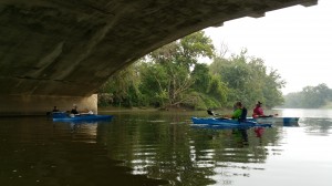
While there have been several improvements from the Regional Development Authority, the report points out several concerns that the region is facing.The WorkOne Northern Indiana’s State of Workforce report discusses the K-12 Educational performance. The poorest performing districts in the region are concentrated in the urban core of northern Lake County. Rural areas in the southern portion of the region and the Michigan City-La Porte areas are also below the state average. The region also has a disparity with walkable communities and the aging population which it points out has continued to grow since 1980. Regional attractions continue to keep the tourism economy above water, including the only area where Indiana touches a great lake, the Indiana Dunes stretching 25 miles and the growing off-road trail network. With additional improvements being made to the South Shore Line, the state sees approximately $14.0 Million in sales and income tax revenue but could expand that capacity to nearly $55 Million once the development from the line has finished a full decade of operation. Through the entire report, there is a heavy emphasis on the expansion and rehabilitation of the famed South Shore Line and what it will do for the region and the state.
PRIORITY PROJECTS FOR THE NWIRDA “The Region”
1. The South Shore Line – Double Tracking $114 Million (The entire $42 Million from Regional Cities would be used toward this project)
Currently a double track, sharing right away with the Metra Electric District in Chicago, once reaching Tennessee street in Gary the line becomes a single track. Only a small 6 mile portion of the line in eastern Lake County and western Porter County are double tracked at this current time. Creating a continuous double track from Michigan City to the current connection in Gary will increase scheduling flexibility, improve reliability, expand maintenance windows and eliminate the single point of failure that currently exists. By creating a safer and stronger South Shore Line, the region can benefit economically which will have spin off benefits in regards to education, workforce development and alike.
VISIONARY AND PLANNED PROJECTS FOR THE NWIRDA “The Region”
2. Positive Train Control $80 Million
Federally mandated train control systems are intended to prevent train-to-train collisions, eliminate work zone incursions, and automatically enforce all speed restrictions. With the use of high-tech, integrated electronic signal systems, and controls interfaced with GPS, the project is necessary for the region and continued operation of the South Shore Line.
3. New Car Orders $250 Million
Several of the cars on the South Shore Line have been in service for over 40 years, including 41 cars purchased in 1982 making the amenities outdated with the conveniences expected today.
4. Metra Capacity $30 Million
The South Shore Line operates on Metra Electric District right-of-way from 115th street to Millennium Station in downtown Chicago. The current site is a four-track railroad from 115th street to 11th place and shrinks to a three-track railroad on approach to Millennium Station. After the station, it is a single track leading into four platforms. The single track causes a single point of failure and in the event of a derailment or an unexpected track, switch, or catenary failure, all the trains would be indefinitely ensnared. The $30 Million capital project would provide an additional track into Millennium Station.
5. West Lake Extension $571 Million
The West Lake extension would expand the commuter rail service south into Lake County. The service would greatly reduce the length of travel time and distance that southern Lake County commuters would have to travel to access the South Shore train service. The current extension is in the initial planning stages, having completed concept feasibility assessments.
6. Market Expansion $7 Million
The improvements on the existing line are to increase efficiency and reduce travel by 39 minutes. The Portage/Ogden Dunes station is being equipped with three warming shelters and two ADA mini-high level boarding platforms. The project would construct dual, 8-car long, high-level boarding platforms with gauntlet tracks to safely separate freight trains.
7. Michigan City Realignment $109 Million
The elimination of two miles of embedded street running track will include the construction of a new exposed ballasted double track railroad within the 10th/11th street corridor coupled with a modern, fully equipped consolidated station and 88-car high-level
8. South Bend Realignment $20 Million
South Shore trains must currently navigate a reverse C in order to access the airport terminal from the east. The route is long and trains are slowed by nearly 25-grade crossings. The realignment project would provide a more direct route to the west side of the airport by eliminating three miles of track and reducing time up to 10 minutes. It would also cut the number of grade crossings to 7 providing a more efficient and safe mode of transportation.
9. Gary Station Improvements $38 Million OR $52 Million
Upgrades to the South Shore Line must include a review of the Gary stations. Three in Gary have low level boarding platforms and these are past the end of their current useful life. Alternatives would close the Clark Road station, upgrade the Miller and Gary Metro stations with high level boarding platforms and include travel time improvements.